Subdividing Land
Subdividing Land With Confidence & Clarity
Subdividing land adds value; and clear process makes all the difference. Getting it right means navigating council approvals, planning rules and surveying requirements. With our expert guidance and well-managed steps, it's possible to move from concept to title efficiently while avoiding costly delays and potential setbacks so you can make the most of your land.
Urban Subdivisions
Subdividing residential land? Avoid surprises with expert help from start to approval.
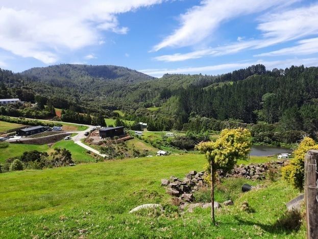
Rural Subdivisions
Subdivide farmland or lifestyle blocks with a process that’s practical, cost-conscious and council-ready.
Subdivision Process
Subdivision is a complex, highly regulated process that often takes a year or more to complete. From council requirements to construction and legal steps, there’s a lot involved. We’ll guide you through every stage - managing the process so you can get your titles as smoothly and quickly as possible.
The process includes:
01.
A full Resource Consent Application is presented to Council including many reports and plans covering site detail, building suitability, planning rules, environmental, contamination and often more.
02.
Council considers all the effects and will issue a consent detailing the conditions that need to be completed including legal and construction items.
03.
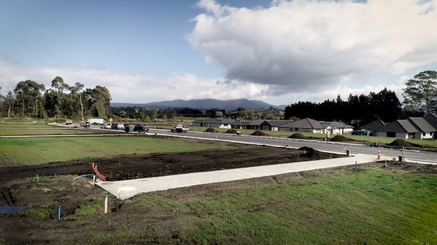
Construction of access and services for all new sections including electricity, water and wastewater must then be undertaken in accordance with tight specifications.
04.
Our team will meet the requirements on your behalf to certify to Council that all construction and legal conditions have been satisfied precisely in accordance with the consent.
05.
A legal survey is required to establish new boundaries and align with adjoining ones. The outcome is the white boundary pegs you will see on site, which form the basis of a new state-guaranteed title.
06.
Council approves the process at various stages and following their final approval - the survey is approved by Land Information New Zealand.
07.
Your solicitor then obtains the final titles through Land Information New Zealand and you are then able to sell the land.
Our expert team will guide you every step of the way with the clarity and guidance required so you can make the most of your land.
Subdivision & Survey Essentials:
Process • Costs • Timing
Subdivision
COSTS:
There are many variables in undertaking a subdivision and as a result costs can vary. They will also vary between districts and with the size of the subdivision and the type of land to subdivide. The main costs are generally but not limited to:
Preparation of a detailed Resource Consent Application including site plans and an Assessment of Environmental Effects.
Negotiation with Council in relation to conditions of consent.
Approval of the consent by Council, including detailed conditions.
Design of access and service connections in accordance with the conditions of consent.
Installation of services (power, water, wastewater and accessways).
Council fees including application and Development Impact Fees are significant.
Specialist reports (engineers, planners, geotechnical, traffic design, etc.).
Legal surveying and lodgement of data with Land Information New Zealand.
As a guideline for a straightforward subdivision creating one new title; you can expect to invest upwards of $100,000 excluding construction of services and any development contributions your local council may require. For multiple titles there is often a significant saving per title on the costs of servicing.
TIMING:
Surveying takes time - and planning.
Accurate work can’t be rushed. Research, calculations, and coordination all happen before any pegs go in the ground. Time is also needed to confirm details with you and align with other consultants involved in the project.
For the best outcome, get in touch early - not the day before the work is needed.
USEFUL TIP:
Obtaining a good site (topographic) plan or locating those elusive boundary pegs early in the building or development process will set your project up to run smoothly. Architects and engineers rely on our accurate record of site information to design the best solutions – helping you make the most of your land.
Site Survey
There’s a lot more to surveying than pegs in the ground. A boundary peg or site plan is just the visible result. Behind the scenes, a detailed process is already in motion - long before anyone steps foot on site.
Property titles, survey history, easements, height data and boundary research are all investigated first. Then come the calculations, planning, and technical setup that ensure fieldwork runs smoothly and accurately.
Once onsite, the pace is efficient because the groundwork has already been locked in. It doesn’t stop there - back in the office, plans are completed, certifications are prepared, and every detail is quality-checked for Council or LINZ.
It’s not just a field visit, it’s a professional process that needs time, care and specialist knowledge from start to finish.
Advance notice ensures it’s done right, first time.
SITE SURVEY COSTS:
The costs for these various surveying tasks vary depending on the site conditions, age of the title, information available and detail required.
As a guide, the following range should give you a general idea of what to expect. However, we price all projects individually:
Marking existing boundaries for either building or sale purposes - $1,900 to $4,500 range.
A site (topographic) survey - upwards of $3,000.
Certification to Council in relation to building position or site coverage - $2,000 to $6,000.
TIMING:
Surveying takes time and planning.
Accurate work can’t be rushed. Research, calculations, and coordination all happen before any pegs go in the ground. Time is also needed to confirm details with you and align with other consultants involved in the project.
For the best outcome, get in touch early, not the day before the work is needed.
USEFUL TIP:
Obtaining a good site (topographic) plan or locating those elusive boundary pegs early in the building or development process will set your project up to run smoothly. Architects and engineers rely on our accurate record of site information to design the best solutions - helping you make the most of your land.
Thinking of building or developing? Get your project off on the right foot.
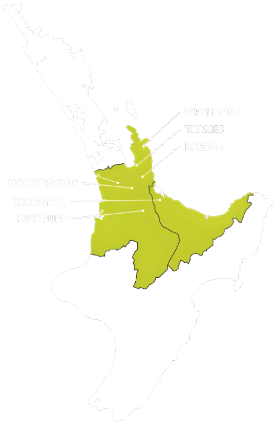
TAURANGA - BAY OF PLENTY
P: 07 578 2500
tauranga@surveyingservices.co.nz
194 Fifteenth Ave, Tauranga, 3112
WHITIANGA - COROMANDEL
P: 07 866 0088
whitianga@surveyingservices.co.nz
26 Lee Street, Whitianga, 3510
THAMES - COROMANDEL/HAURAKI
PAEROA - HAURAKI
MORRINSVILLE - MATAMATA PIAKO
PUTARURU – SOUTH WAIKATO
HAMILTON - WAIKATO